Best Hiking Trails in Wicklow: Your Complete Guide to the Garden of Ireland
Discover the best hiking trails in Wicklow from Glendalough's monastic walks to Wicklow Way adventures. Expert local insights for Ireland's premier hiking county.

County Wicklow sits just south of Dublin, offering Ireland's most diverse hiking terrain within an hour of the capital. Known as the Garden of Ireland, Wicklow packs glacial valleys, granite peaks, pristine lakes, and dramatic coastlines into 2,025 square kilometers. What sets Wicklow apart from other Irish counties is its accessibility - you can hike from sea level to 925 meters elevation in the same day, moving between ancient monastic sites and untouched mountain wilderness.
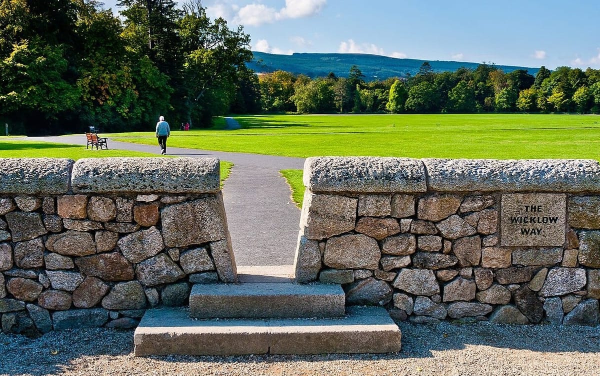
The county's hiking infrastructure surpasses anywhere else in Ireland. The Wicklow Way, Ireland's first long-distance trail, established the template for waymarked routes across the country. But beyond the famous trails, Wicklow offers everything from gentle forest walks suitable for toddlers to technical mountain routes that challenge experienced alpinists. The Wicklow Mountains National Park protects much of the county's high country, ensuring these landscapes remain pristine for future generations.
Major Hiking Trails in Wicklow
Wicklow Way
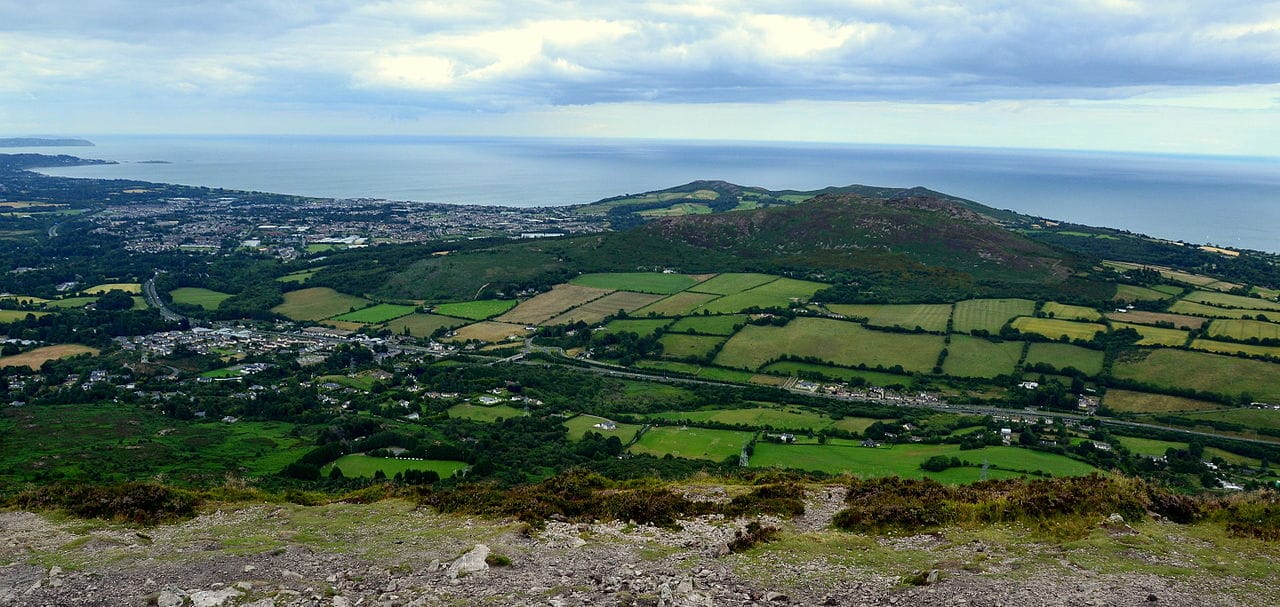
Ireland's premier long-distance trail stretches 127km from Marlay Park in Dublin to Clonegal in Carlow, with 85km traversing Wicklow's heartland. The Glendalough to Glenmalure section (20km) offers the most spectacular mountain scenery, crossing the Wicklow Gap at 478 meters elevation. This challenging day hike takes 6-8 hours and requires proper mountain gear. Unlike crowded sections near Dublin, this central portion provides genuine wilderness experience. The trail surface varies from boardwalks across bog to rocky mountain paths that become treacherous in wet conditions.
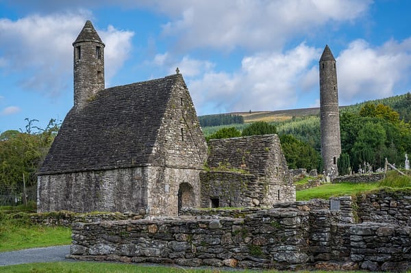
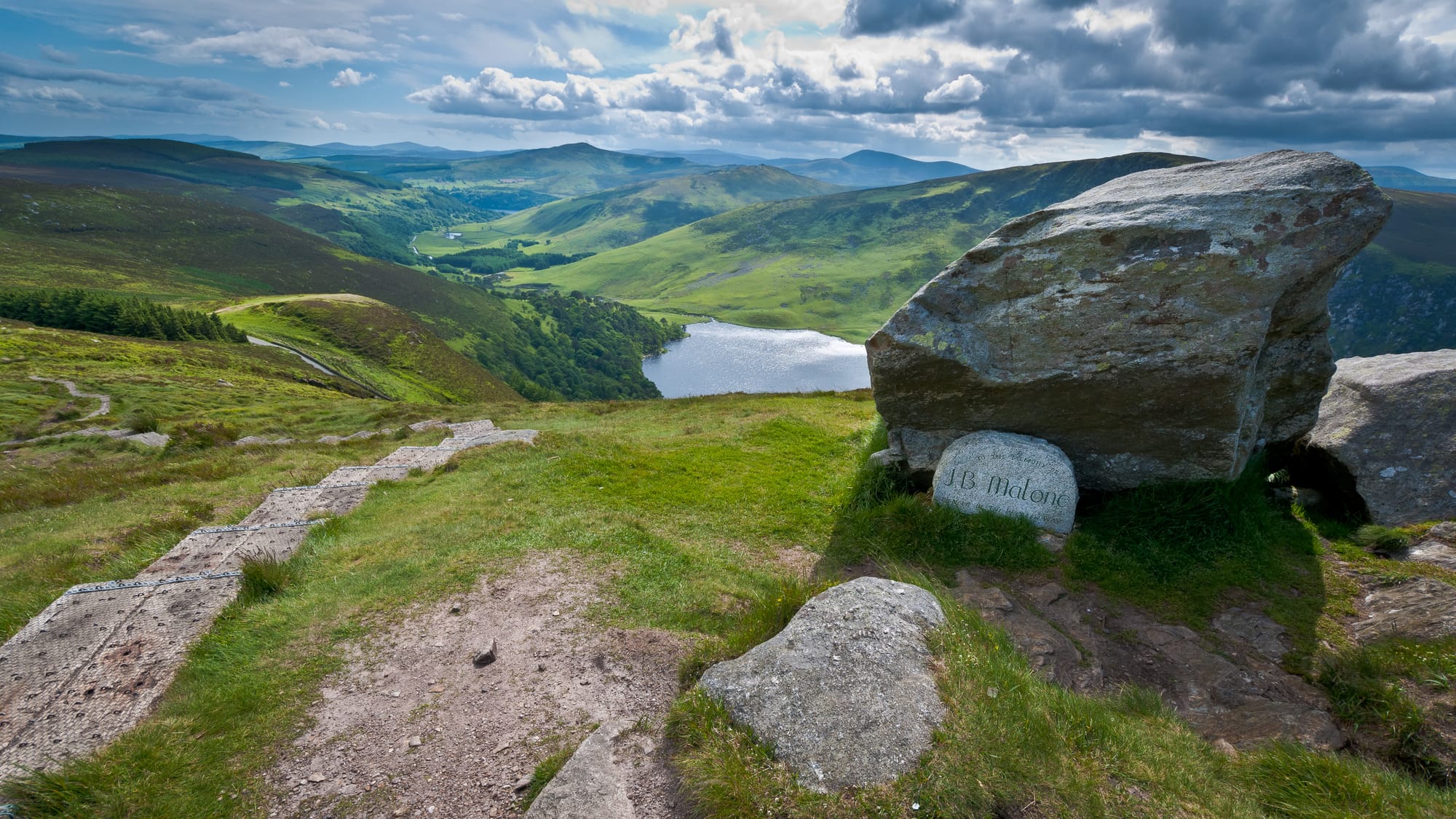
Glendalough Valley Trails
Multiple waymarked routes radiate from Ireland's most famous monastic site. The Glendalough Blue Route (4.5km, 2 hours) follows the Upper Lake shoreline to the old mining ruins, offering easy walking with dramatic mountain backdrops. The more challenging Green Route (9.5km, 4 hours) climbs through Glenealo Valley to the Wicklow Way junction. Early morning visits avoid tour bus crowds, while afternoon light creates better photography conditions on the lakes. The Glendalough Visitor Centre provides detailed trail maps and current conditions.
Lugnaquilla Mountain
At 925 meters, Lug dominates the Wicklow skyline and attracts serious mountain hikers. The Fenton's Route from Glen of Imaal (12km return, 5-6 hours) offers the most direct ascent through dramatic corrie terrain. This challenging hike requires navigation skills and proper mountain equipment. Weather conditions change rapidly above 600 meters, making this unsuitable for novice hikers. The final approach involves scrambling over loose scree, and the summit plateau can disorient walkers in cloud. Multiple fatalities occur here annually, emphasizing the need for mountain experience.
Bray Head Cliff Walk
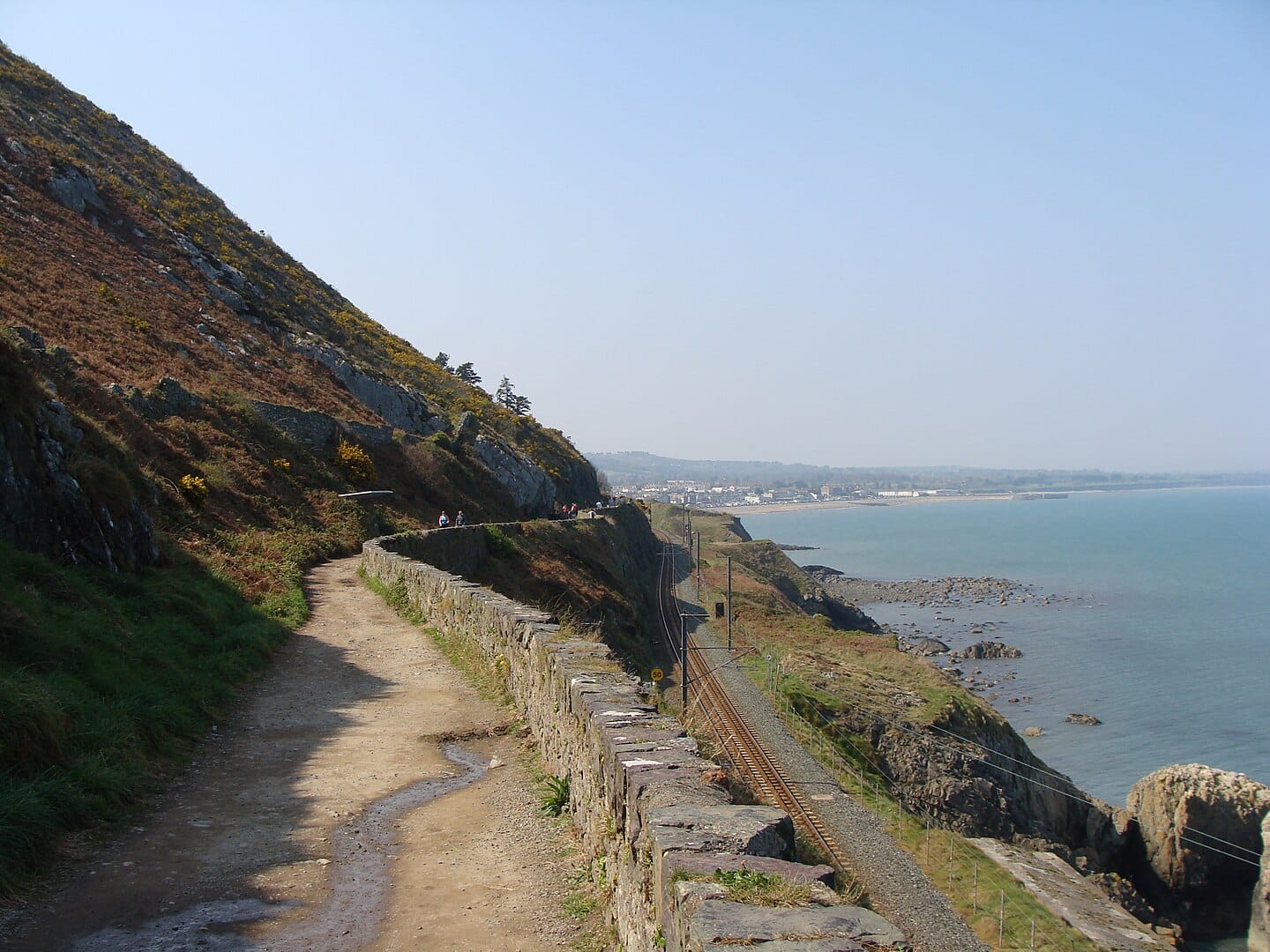
This spectacular 7km coastal route links Bray and Greystones via dramatic cliff paths 200 meters above the Irish Sea. The well-maintained trail takes 2-3 hours and offers constant ocean views toward Howth and Dublin Bay. The path includes several challenging climbs but remains accessible to most fitness levels. Strong winds make this dangerous during storms, and the exposed nature means waterproofs are essential even on sunny days. The Greystones end connects to DART rail service for easy return to Dublin.
Djouce Mountain Circuit
Starting from the R115 Sally Gap road, this 8km loop (4 hours) combines mountain hiking with lakeland scenery. The route passes Powerscourt Waterfall before climbing to Djouce's 725-meter summit. Views extend across the Irish Sea to Wales on clear days. The descent via White Hill provides different perspectives of the Dargle Valley. This trail offers an excellent introduction to Wicklow mountain hiking without the technical challenges of Lugnaquilla.
Spinc and Glenealo Valley
The famous Spinc walk (11km, 4-5 hours) climbs dramatically above Glendalough's Upper Lake before descending through the wild Glenealo Valley. This challenging route includes steep boardwalk sections that become slippery when wet. The viewpoint above the lakes provides Wicklow's most photographed vista. The return through Glenealo offers a complete contrast, following an ancient glacial valley past mining ruins and mountain streams.
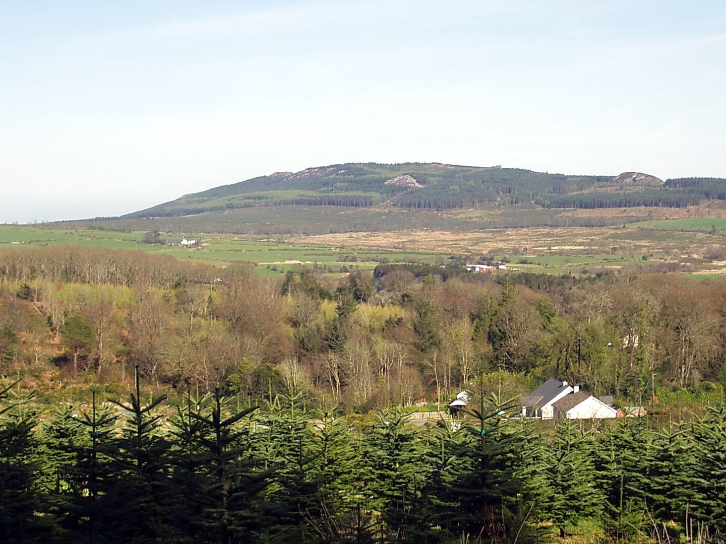
Great Sugar Loaf
Wicklow's most distinctive peak (501m) offers a challenging but short climb (4km return, 2-3 hours) with panoramic coastal and mountain views. The initial approach through gorse and heather gives way to steep, rocky terrain requiring hands-on scrambling. Despite its modest height, this hike demands respect - the exposed summit can be dangerous in high winds. The car park on the R755 provides convenient access, but spaces fill quickly on weekends.
Wicklow Head and Silver Strand
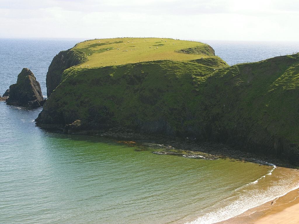
This 6km coastal walk from Wicklow town combines lighthouse history with dramatic cliff scenery. The route follows ancient smuggling paths above Silver Strand beach before reaching Wicklow Head lighthouse. Rock pools and bird watching opportunities make this excellent for families, though coastal erosion means staying well back from cliff edges. The sheltered Silver Strand provides swimming opportunities during the summer months.
Hidden Wicklow Hiking Spots
Seahan and Seefin Mountains
Most hikers focus on higher peaks, leaving these twin summits (Seahan 694m, Seefin 724m) remarkably quiet despite spectacular views. The 10km circuit from the Wicklow Gap road passes prehistoric burial cairns and offers 360-degree panoramas without the crowds found on more famous mountains. Local hill walkers have used these routes for generations, creating an informal network of sheep tracks that connect to the main Wicklow Way. Navigation skills are essential as these paths disappear in poor weather.
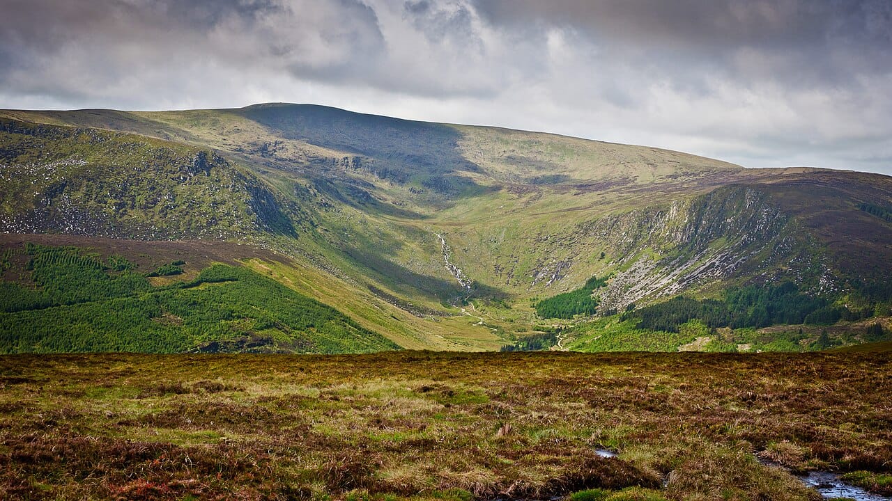
Glenmalure's Hidden Valley
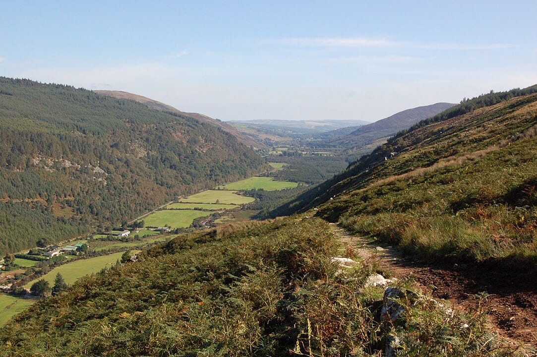
Beyond the well-known Glenmalure Lodge area, a network of old military roads and mining tracks penetrates deep into the eastern Wicklow Mountains. These routes, originally built during the 1798 Rebellion to pursue United Irishmen, now provide access to some of Ireland's most remote mountain country. The 12km circuit from Drumgoff to Art's Lough requires serious navigation skills but rewards experienced hikers with complete solitude among dramatic corrie lakes.
Carrick Mountain from Bahana
This alternative approach to Carrick Mountain (661m) starts from the tiny hamlet of Bahana, following old turf-cutting tracks through blanket bog. The 8km route reveals a landscape unchanged since medieval times, where local families still exercise traditional turbary rights. You'll encounter working bog holes and hear stories from locals about generations of turf cutting. The summit provides views down to Blessington Lakes while avoiding the more popular approaches from Lacken.
Deputy's Pass to Scarr
Local farmers still drive cattle through this ancient pass between Roundwood and Laragh, maintaining a tradition dating to pre-Norman times. The unmarked 6km trail follows stone walls and field boundaries that haven't changed in centuries. Scarr Mountain (641m) provides an easier alternative to nearby Tonelagee, with equally impressive views but fraction of the foot traffic. Spring brings spectacular displays of bog cotton and mountain flowers along this traditional drove road.
Glenmacnass Valley Circuit
While everyone stops at Glenmacnass Waterfall, few explore the hidden valley that extends westward into the heart of the Wicklow Mountains. This 9km circuit follows the Glenmacnass River to its source before climbing over Kanturk Mountain (525m) and returning via the plateau above the waterfall. The route passes abandoned farmsteads and reveals how dramatically the population declined here after the Famine. Red deer sightings are common in early morning.
Event Calendar
Spring (March-May)
The Wicklow Way Challenge in April attracts hundreds of hikers attempting various sections of the famous trail. Local walking groups organize heritage walks during this period, including special access to normally restricted areas around Glendalough. The Wicklow Gardens Festival in May combines hiking with visits to the county's famous gardens, many accessible only via walking trails through private estates.
Summer (June-August)
Midsummer brings the Wicklow Mountains National Park's guided walks program, featuring specialist botanist and wildlife expert-led hikes. The Glendalough Heritage Week in July includes archaeological walks to sites normally closed to the public. August's Blessing of the Wells ceremony at various mountain holy wells continues traditions dating to Celtic times, with pilgrimage walks connecting sacred sites across the county.
Autumn (September-November)
October's Wicklow Autumn Walking Festival showcases the county's best trails during peak foliage season. The traditional sheep gathering from mountain commons brings working dogs and farmers together, maintaining ancient pastoral practices visible to hikers. November sees the return of deer stalking season, which affects access to certain mountain areas but provides opportunities to observe traditional Highland practices.
Winter (December-February)
Winter solstice walks at ancient stone circles and burial sites attract both archaeologists and casual hikers. The Wicklow Christmas Tree Festival includes guided walks through forestry plantations where most of Dublin's Christmas trees originate. January brings ice climbing opportunities on frozen waterfalls, while February's calm weather often provides the clearest mountain views of the year.
Family Activities
Clara Lara Fun Park Forest Walks
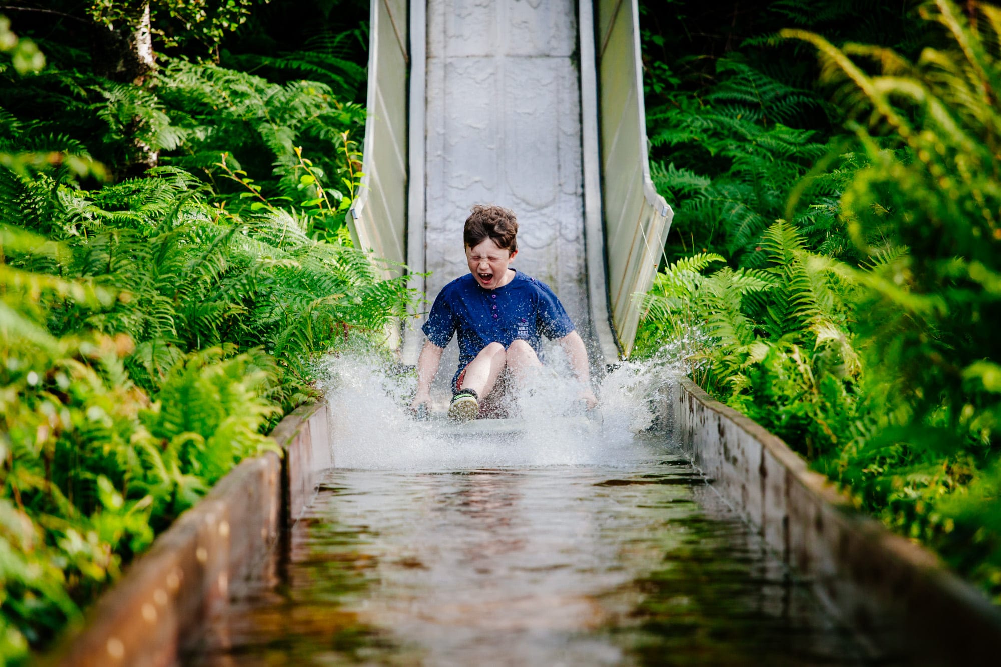
Beyond the adventure park attractions, the site includes several marked walking trails through native woodland. The longest circuit (4km) takes about 90 minutes and showcases the Vale of Clara's natural beauty. These trails remain less known to hikers focused on mountain routes but offer excellent wildlife watching. The all-weather facilities make this perfect for unpredictable Irish weather, and different route options cater to various age groups.
Powerscourt Waterfall Trails
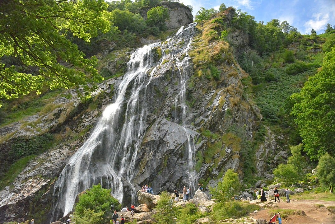
Ireland's highest waterfall provides the centerpiece for several family-friendly walking routes. The easy 2km circuit suits toddlers and buggies, while the 5km trail to Djouce Wood challenges older children. The site includes picnic areas and public facilities, making it ideal for full-day family outings. Entrance fees apply but include access to all walking routes and the visitor center.
Avondale Forest Park
Charles Stewart Parnell's former estate offers 518 hectares of mixed woodland with waymarked trails ranging from 1km to 7km. The shortest routes suit families with young children, while longer circuits provide moderate hiking challenges. The visitor center includes interactive exhibitions about Irish forestry and Parnell's political legacy. Tree climbing and orienteering activities keep children engaged between walking segments.
Blessington Greenway
This 6.5km lakeside trail follows the old railway line around Blessington Lakes, providing flat, paved walking suitable for buggies and wheelchairs. Multiple access points allow families to choose shorter sections, while the full route takes about 2 hours at family pace. Water sports centers along the route offer additional activities, and several cafes provide rest stops with lake views.
Wicklow Gaol Heritage Trail
Starting from the restored 18th-century prison, this 3km urban trail through Wicklow town combines history with gentle walking. Children enjoy the interactive elements at the gaol while parents appreciate the historical context. The route connects to coastal walks for longer hiking options, or families can explore Wicklow's shops and restaurants after the heritage experience.
Local Business Highlights
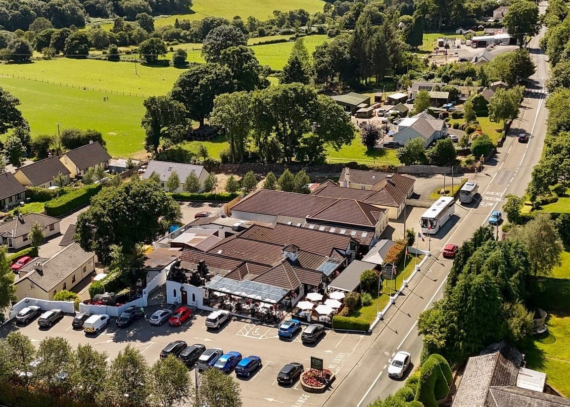
Lynham's Hotel, Laragh
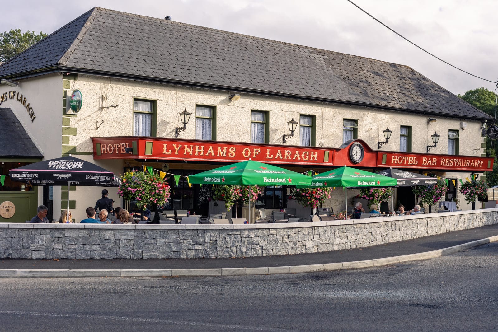
After tackling Glendalough's mountain trails, locals head to this traditional hotel for their famous Irish stew and perfectly poured pints. The hotel has served hikers for over a century, and the owners maintain detailed knowledge of local trail conditions. Their packed lunches have sustained generations of Wicklow walkers, and the cozy bar provides perfect recovery atmosphere after challenging mountain days. Visit Lynham's Hotel for accommodation and dining information.
The Wicklow Heather Restaurant, Laragh
This family-run establishment specializes in locally sourced ingredients, perfect for refueling after mountain adventures. Their homemade brown bread and hearty soups warm hikers returning from the high peaks. The restaurant maintains an informal hikers' information board where walkers share route conditions and organize group hikes. Their early opening hours cater to hikers starting dawn climbs of Lugnaquilla.
Glendalough Hotel
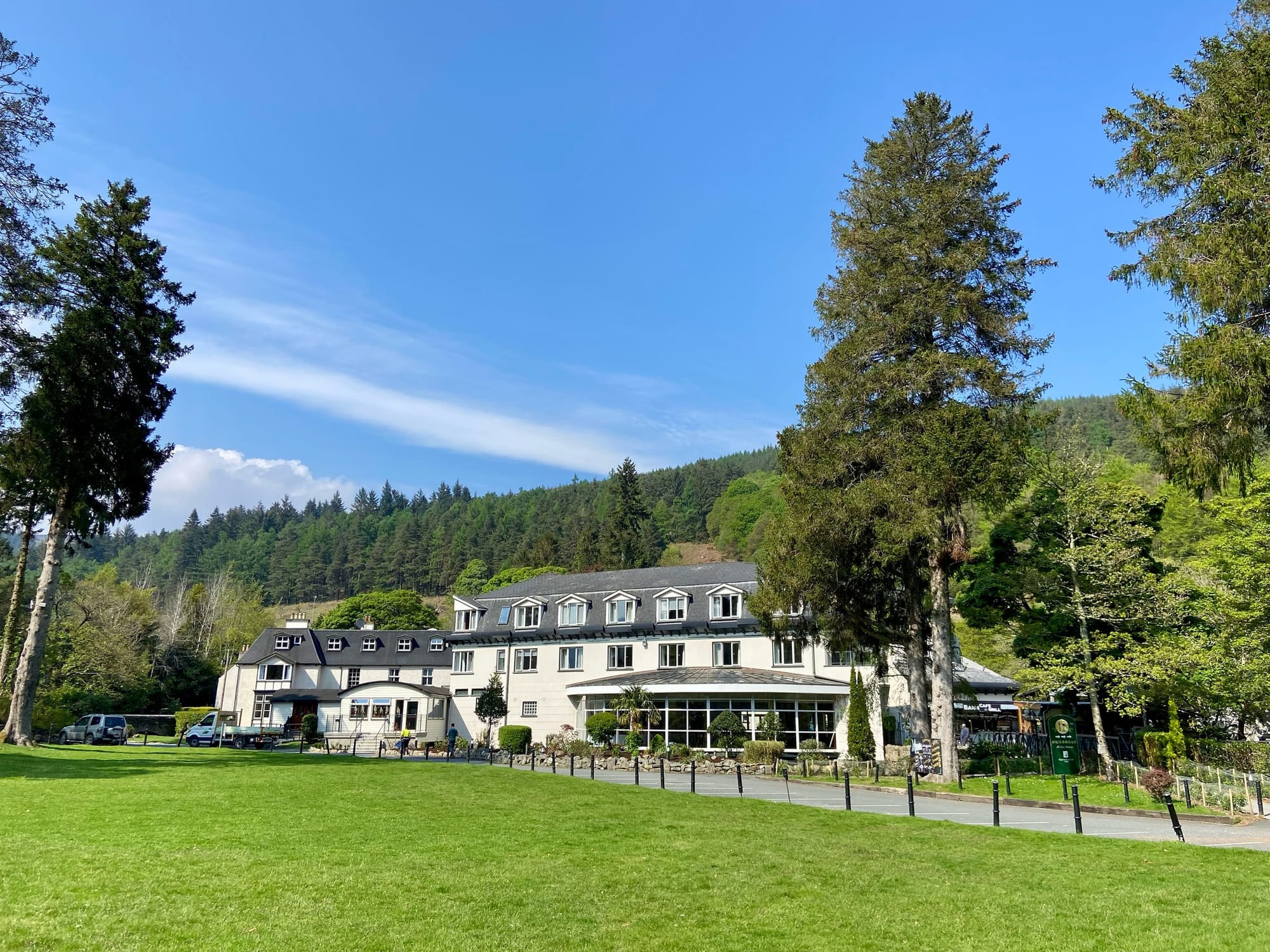
More than just accommodation, this historic hotel serves as the unofficial headquarters for serious Wicklow hikers. The hotel bar displays vintage mountaineering photographs and maintains a lending library of walking guides. Local mountain rescue volunteers often gather here, providing invaluable trail advice to visiting hikers. Their Sunday lunch attracts walking groups from across the county, making it excellent for networking with experienced local hikers.
Outdoor Adventure Store, Bray
Wicklow's premier hiking equipment supplier, run by experienced local mountaineers who know every trail in the county. They offer equipment rental, boot fitting services, and detailed route advice based on current conditions. Their weekly group walks provide excellent opportunities to explore unmarked trails with knowledgeable guides. The shop also serves as an informal meeting point for hiking partner formation.
Seasonal Considerations and Practical Tips
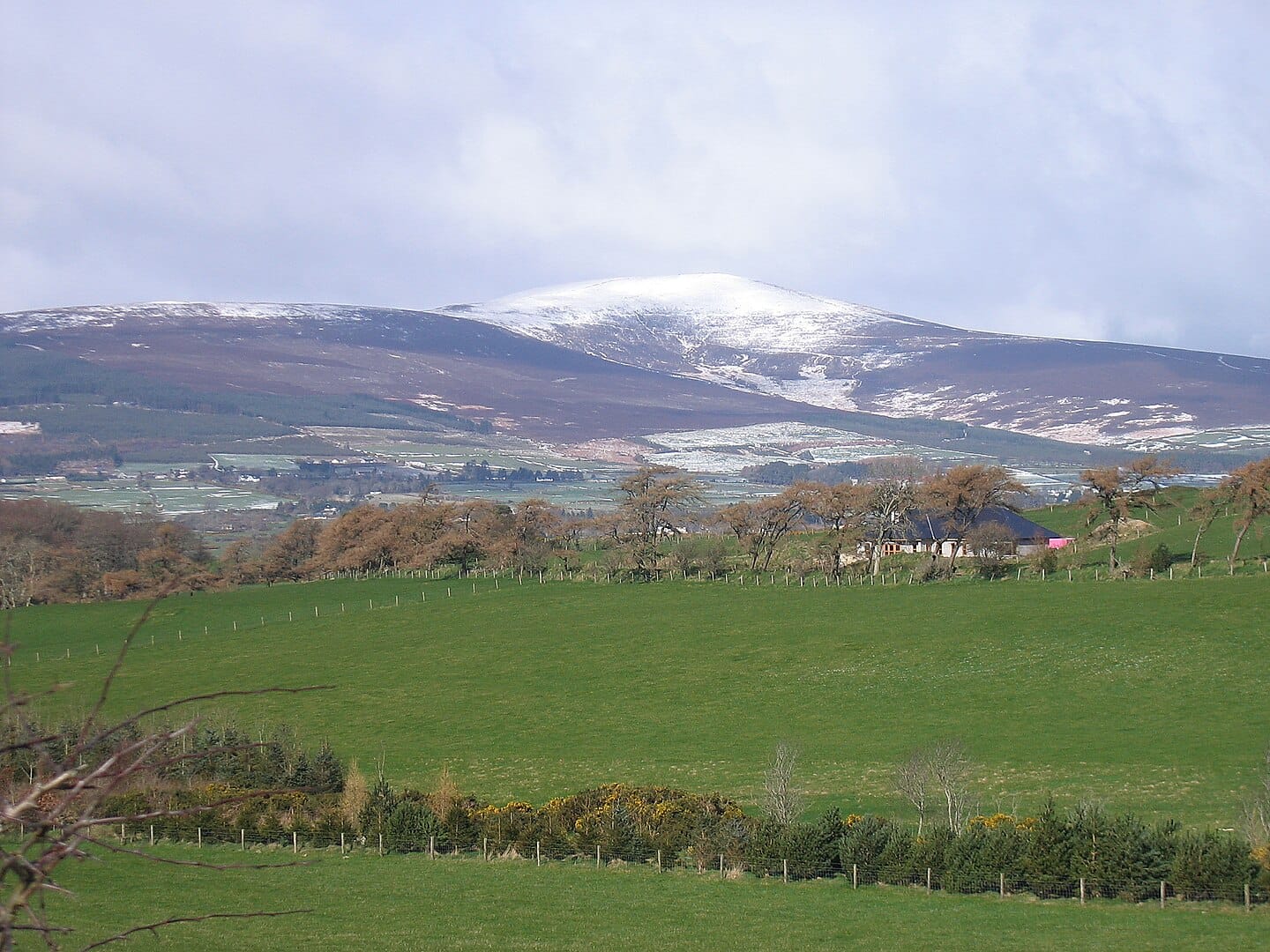
Wicklow's diverse elevation range means hiking conditions vary dramatically with altitude and season. Mountain areas above 400 meters can experience snow when valleys remain green, making proper gear essential year-round. The county's exposed Atlantic position brings rapid weather changes - mountain rescue teams report that inadequate clothing causes most hiking emergencies.
Spring offers the most comfortable hiking temperatures but also the wettest conditions. Wicklow's granite terrain sheds water quickly, creating flash flood risks in valley bottoms. Summer brings the longest days and warmest weather but also peak visitor numbers at popular trails like Glendalough. The most experienced local hikers prefer autumn for serious mountain hiking - cooler temperatures, fewer crowds, and generally stable weather patterns.
Many Wicklow trails cross open mountain terrain with minimal shelter. Even day hikes should include emergency equipment: waterproof layers, extra food, first aid supplies, and navigation tools. Mobile phone coverage remains patchy above 300 meters elevation, particularly in valley areas. The county's granite geology creates unique challenges - wet rock becomes exceptionally slippery, and route-finding can be difficult when cloud obscures landmarks.
Mountain rescue services operate from several bases across Wicklow, but response times increase significantly in remote areas. Always inform someone of your planned route and expected return time. The Dublin and Wicklow Mountain Rescue Team provides excellent safety advice and current conditions updates through their website and social media channels.
Getting Around and Access
Wicklow's proximity to Dublin provides excellent public transport links to trail heads. Dublin Bus serves coastal towns like Bray and Greystones, both connected to the DART rail system. The St. Kevin's Bus service connects Dublin to Glendalough via Roundwood, providing access to numerous mountain trails. However, many of Wicklow's best hiking areas require private transport.
The county's narrow mountain roads can become congested during peak hiking seasons, particularly weekend mornings when Dublin day-trippers head for the hills. Early starts avoid both traffic and crowds on popular trails. Parking at major trail heads fills quickly - Glendalough's car parks overflow by 10 AM during summer weekends. Many experienced hikers use alternative starting points to avoid crowds and parking problems.
Accommodation ranges from basic hostels to luxury country houses, with many establishments specializing in walking holidays. The Wicklow Way passes numerous B&Bs and small hotels, making multi-day hiking feasible without carrying camping equipment. Youth hostels in Glendalough and other locations provide budget options popular with international hikers.
Hiking in Wicklow
Wicklow delivers Ireland's most varied hiking experiences within the smallest geographic area. From gentle lakeside strolls to technical mountain climbs, the Garden of Ireland offers trails for every ability level. The county's unique combination of accessibility and wilderness provides day hiking opportunities unmatched elsewhere in Ireland, while multi-day options challenge even experienced mountain walkers.
The infrastructure supporting Wicklow hiking - from waymarked trails to mountain rescue services - sets standards for the rest of Ireland. Yet this popularity brings responsibility. These mountains can kill unprepared hikers, and the increasing visitor numbers stress both the environment and local communities. Responsible hiking practices ensure these trails remain available for future generations.
Whether you're seeking easy family walks around Glendalough's historic lakes or challenging mountain climbs on Lugnaquilla, Wicklow's hiking trails provide authentic Irish mountain experiences just minutes from Ireland's largest city. The county's trails will continue evolving as new routes open and climate change affects mountain conditions, but the fundamental appeal remains constant: nowhere else in Ireland offers such diverse and accessible mountain hiking.
Now, check out our guide about the best hiking spots in County Meath.
🎯 For Locals
Want more hidden gems, ready-made weekend plans & insider picks? Order one of these quick upgrades (coming soon):
- 📍 Weekend Itinerary Packs – Themed trips with maps, food stops & hidden gems. (e.g. Romantic Wicklow, Rainy Day in Dublin)
- 📍 Hidden Gems by County – Bonus picks not in this guide, organized by region.
We've built something amazing together - 2,500 families discovering the best of Leinster every week.
I'm expanding Leinster Insider to include business partnerships and consulting services for family-focused businesses. Could you reply with:
- What type of family business do you own (if any)?
- Do you know any local business owners who struggle with marketing to families?
- What family businesses in your area deserve more customers?
Just hit reply - takes 30 seconds and helps me connect great local businesses with our community.
Thanks for being part of our 2,500-strong family community!